FORMER BRIDGES, FORDS AND FERRIES
The River Blyth has been crossed at various points by fords. At Blyth the river was crossed by ferries, the last one disappearing only in recent years and soon to be replaced. Bridges were built as the need for permanent crossings arose and many of these have been widened, reconstructed or replaced as traffic increased. The two original timber railway viaducts were replaced by iron structures.
The Blyth Ferry
There has been a ferry at Blyth for many years. The Low Ferry of 1850 and 1873, and the High Ferry, both let to tennants for £5 to £10. In 1873 the Blyth Harbour and Dock Co. took over. The High Ferry had a bad reputation for unseaworthiness and was frequently overloaded.
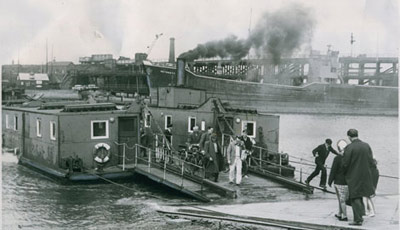
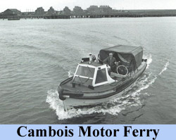
A steam driven chain ferry - the High Ferry - was introduced in 1890 from Cowpen Square to Cambois. The ferry had previously been a rowing boat and was the site of an ancient ford. The ferry was towed across the river by means of the chains. It was used by miners at Cambois pit, workers at Hughes Bolckow shipbreakers yard and power station employees. A direct ferry also operated from the Nelson Inn on Blyth quayside to North Blyth which operated day and night. A later chain ferry carried passengers, bikes and four vehicles and there were two cabins at either side of the space used by vehicles. When the Kitty Brewster bridge opened in 1961 the vehicle ferry ceased to carry vehicles. In 1964 the chain ferry was withdrawn and replaced by a motor ferry, Blyth Harbour Commisioners No 5. The High Ferry operated on the site of an old ford and a rowing boat later ferried people across the river, and then a raft.
There were once proposals for a swing bridge over Blyth harbour near Cowpen Square. The motor ferry was taken off in 1997 and replaced by a bus service via the Kitty Brewster bridge to North Blyth, a six mile detour, though it only ran on Tuesdays, Fridays and Saturdays. There are proposals by Sustrans, the transport charity, for a river bus which will drive onto the river by means of ramps and then become a floating craft. It will carry pedestrians, bikes and pushchairs and is expected to begin operating in 2012. (This plan has apparently been abandoned due to excessive running costs.)
The Cambois Ferry is shown above right.
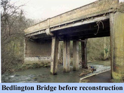
- BRIDGES
- Very near Bedlington Bridge was a Bailey Bridge used to transport open-cast coal from the Acorn Bank site to Bebside. 1955?
- Acorn Bank, Hartford, date not known, Grid Reference NZ 261 798 - footbridge and weir.
- Beanly Cross, near Ogle, date not known, Grid Reference NZ 127798 - footbridge.
- Whinney Hill, date not known, Grid Reference NZ 176 778 - footbridge, beam, timber, replaced by present bridge 1994.
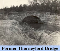
- Thorneyford, date not known, Grid Reference NZ 156 773 - bridge, stone, arch, replaced by present bridge 1964.
- Thorneyford, date not known, Grid Reference NZ 154 774 - footbridge, no details.
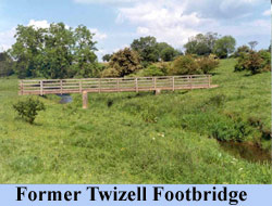
- Twizell Farm, date not known, Grid Reference NZ 157 788, - footbridge, beam, timber, 3 span, replaced by present bridge 2007.
- Trewick, date not known, Grid Reference NZ 192 796 - footbridge, no details, replaced by present bridge 1908.
- Bradford House, date not known, Grid Reference NZ 065 797 - footbridge, no details, replaced by present bridge, not known .
- Sandybraes, date not known, Grid Reference NZ 034 786 - footbridge, no details, replaced by present bridge not known,
- FORDS and FERRIES
- Blyth Direct (Low) Ferry - from Nelson Inn quayside to North Blyth.
- Blyth High Ferry - from Cowpen square to North Blyth and Cambois.
- Blyth ford - replaced by High Ferry.
- Kitty Brewster ford - just east of railway viaduct.
- Furnace bridge ford - just east of present bridge
- Humford (and stepping stones) - near Humford Mill.
- Hartford - just west of Hartford Bridge.
- Plessey Mill stepping stones - north of Plessey Mill farm.
- Carter Moor stepping stones - south of Startup, Grid Reference 168 779.
- Twizell Farm ford and stepping stones - south of Twizell Farm.
- Twizell Farm ford - near present footbridge.
- Twizell Farm ford - north west of farm, Grid Reference NZ 154 791.
- Ogle Dean ford - on site of present footbridge
- Trewick ford - just west of present bridge
- Blyth Bridge East ford - near present footbridge.
- Saugh House ford - near present footbridge.
- Harnham ford - near present footbridge.
- Bradford House ford - on site of present bridge.
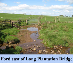
- Long Plantation ford - east of present bridge, Grid Reference 067 789.
- Brandy Well Hall stepping stones - west of Long Plantation, Grid Reference NZ 049 789.
- Sandybraes ford - at site of present bridge.
