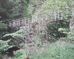
ALLENSFORD TO DERWENT SOURCE

"From its source among the moors, which once formed the lawless borderlands between Durham, Northumberland and Cumberland, the river rumbles 300 metres over 35 miles of steep wooded valley to Derwenthaugh, where it flows into the Tyne."
Guide To The River Derwent. Jas. F. Robinson. 1892
The final stretch of the Derwent, athough it passes the familiar attractions of the Derwent Reservoir and Blanchland, flows through what is mostly little-known country after leaving Allensford and has few bridges. In a deep valley at first, it soon embarks on a series of twists and turns to the north of Muggleswick Common near to where one of its more obscure bridges is situated. Running to the north of the quiet village of Edmundbyers, the course of the river changed in 1967 when the Derwent Reservoir was built. A little to the west is the attractive village of Blanchland with its old stone bridge dividing the County of Durham from Northumberland.
Leaving Blanchland, the final road bridge is reached less than a mile to the west and then comes the last bridge of all on the Derwent near the isolated hamlet of Hunstanworth before the River Derwent proper divides, its tributaries having their source high up on the moors between the Derwent and the River Wear to the south. Here Beldon Burn, Nookton Burn and many smaller streams feed the Derwent. This whole area was once lead mining country, its heyday being in the 18th and 19th centuries after which it largely died out. The major company was the London Lead Company which also had mines in the Alston area of Cumbria.
- Leadmill footbridge - 1950s
- Eddy's Bridge - 1901
- Derwent Bridge - 1829
- The Derwent Reservoir - 1967
- Carrick Bridge - 1967
- Blanchland Bridge - 1842
- Bay Bridge - about 1829
- Hunstanworth Footbridge - not known

